I’m currently typing this with a piece of surprisingly expensive gadgetry strapped to my face–a gadget I wasn’t sold on until I downloaded an app called Voyager about an hour ago. The app, which is free, was developed by ForeFlight, a software company owned by Boeing, and was designed for Apple’s new VR headset, the Vision Pro.
I haven’t had long to play around with it, so, for now, I’ll say this: this app is cool. Really, really, really cool. Though they don’t do it justice, I’ve posted a few screenshots from the experience.
How it works
Essentially, Voyager uses high-resolution satellite maps, terrain data, and live airplane traffic to bring airports from around the world to life. It allows you to view everything on a floating disk that you can inspect from any angle. The level of detail is unbelievable.
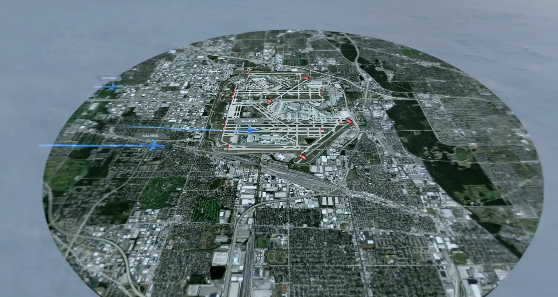
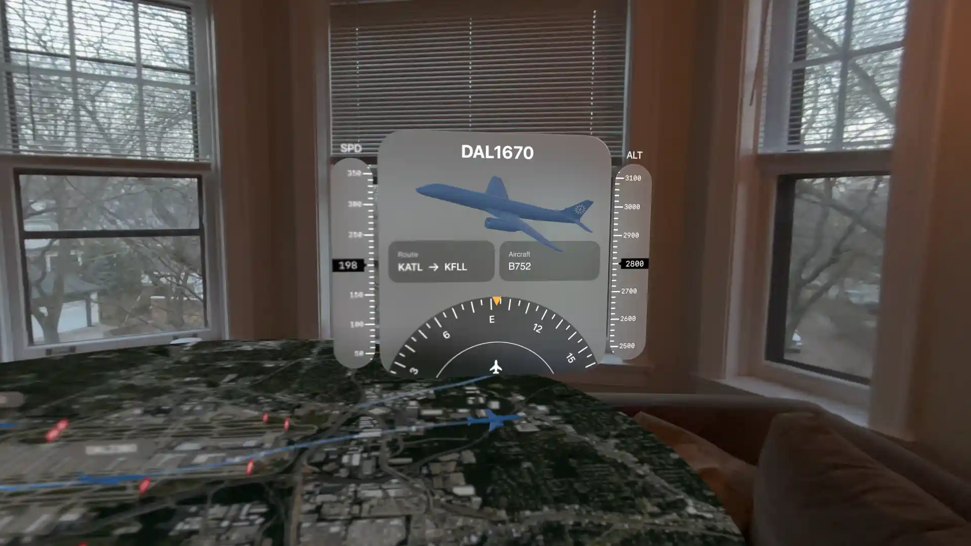
I chose to view Atlanta Hartsfield-Jackson first. Dozens of tiny commercial jets, business jets, propeller planes, and helicopters streamed along their flight paths in and out of the airspace around the disk, all shown at perfectly to-scale sizes and altitudes. Selecting any aircraft tells you its flight number, aircraft type, altitude, heading, and more. I genuinely believe this might be as good as sitting in the control tower at ATL.
Screenshots
Below are a few screenshots (eyeshots?) from the experience, beginning with one showing what I was looking at when I pulled up ATL in my living room.
The closer I walked toward the floating disk, the more detail I could see of planes taking off and landing.
I can also select planes to see more detail on an individual flight–below is the 5:45 departure from Atlanta to Fort Lauderdale.
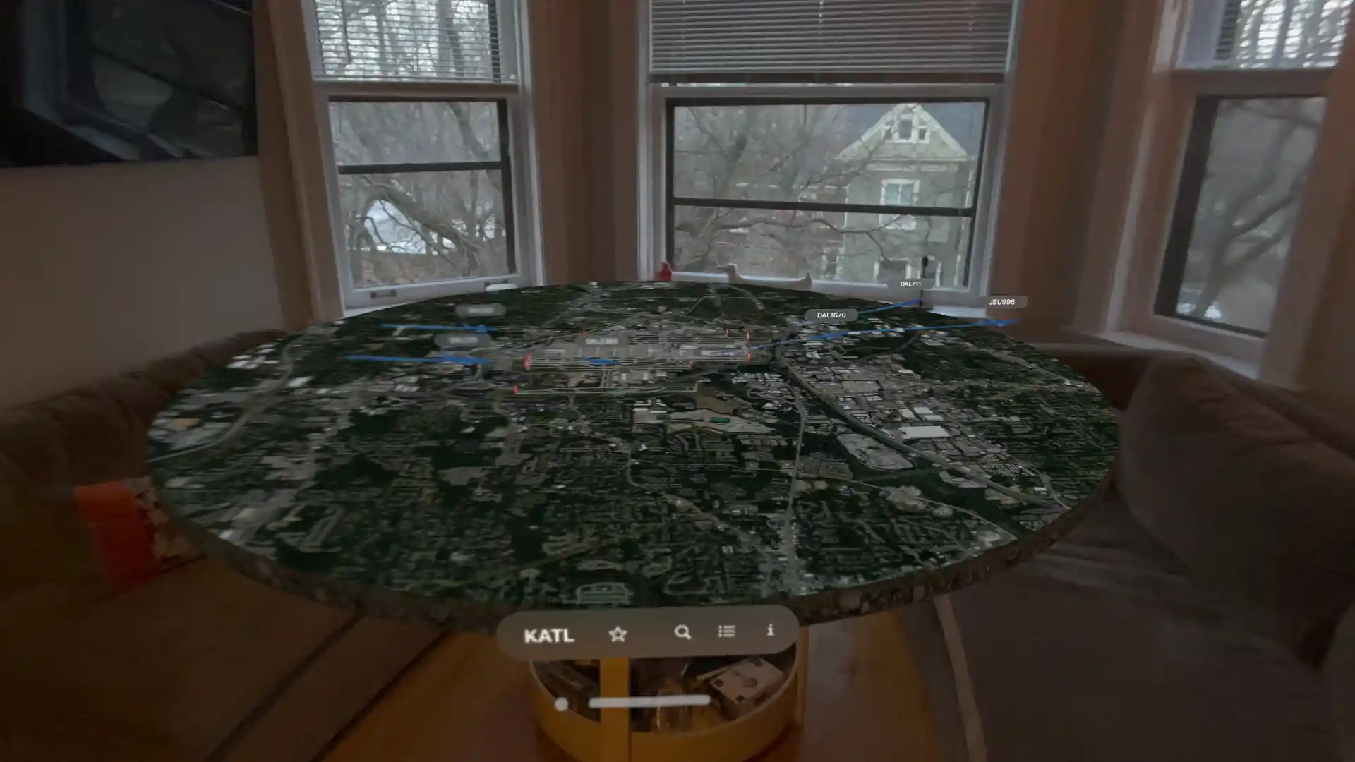
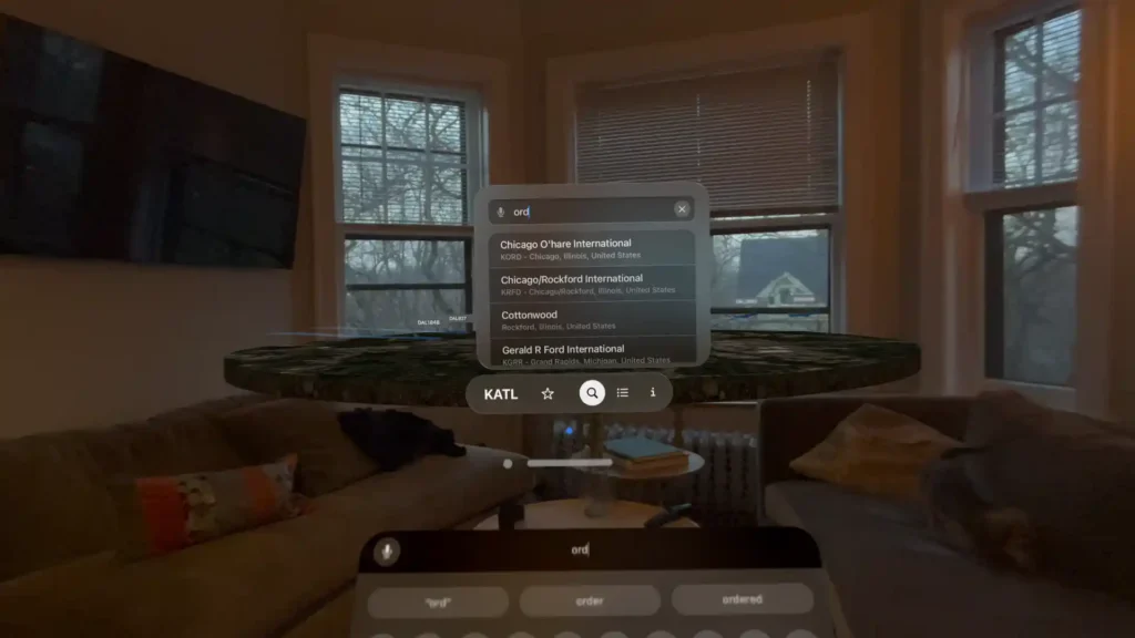
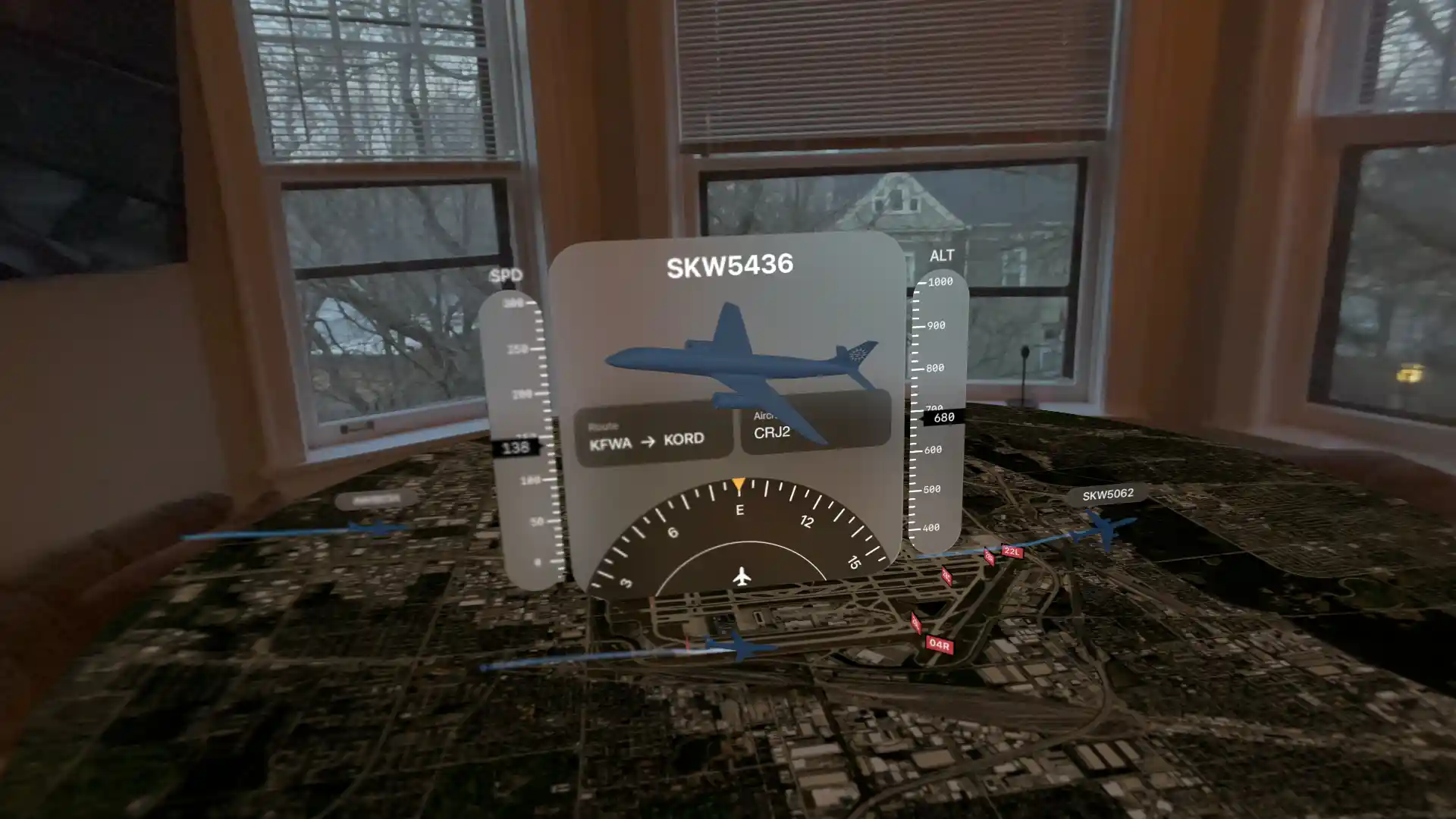
Next, I searched for my home airport, Chicago O’Hare.
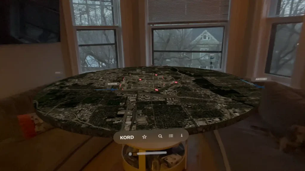
Once again, a floating disk containing a satellite map of O’Hare and surrounding areas popped up above my coffee table.
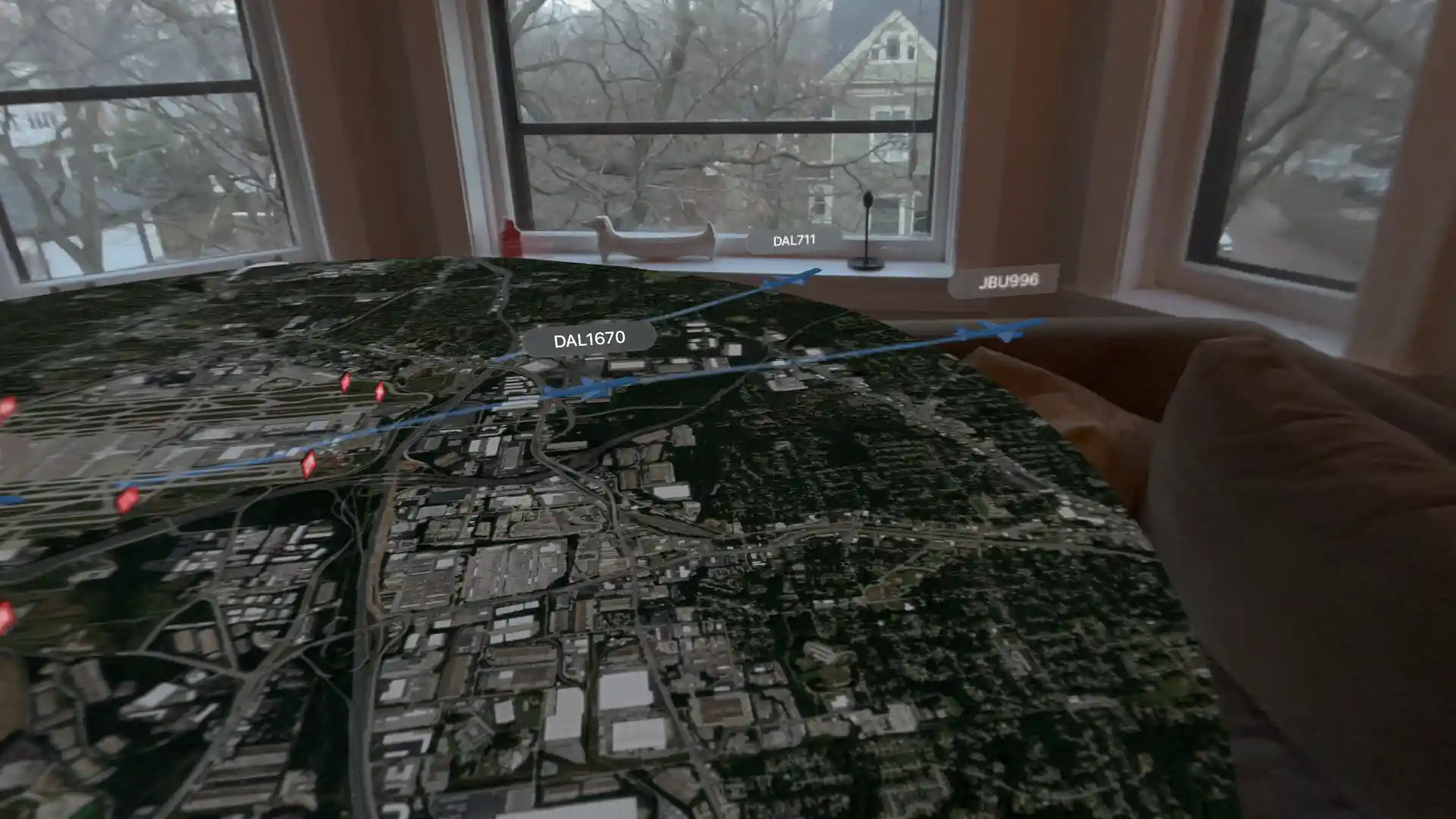
I walked towards runway 10R and watched a SkyWest flight from Fort Wayne come into land.
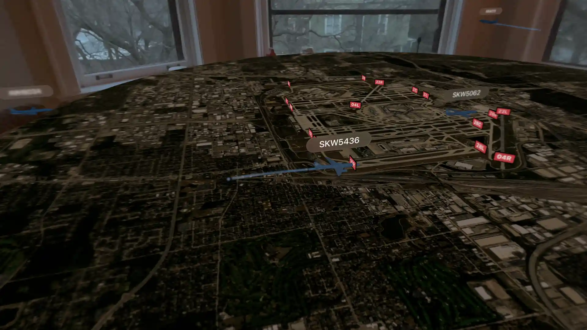
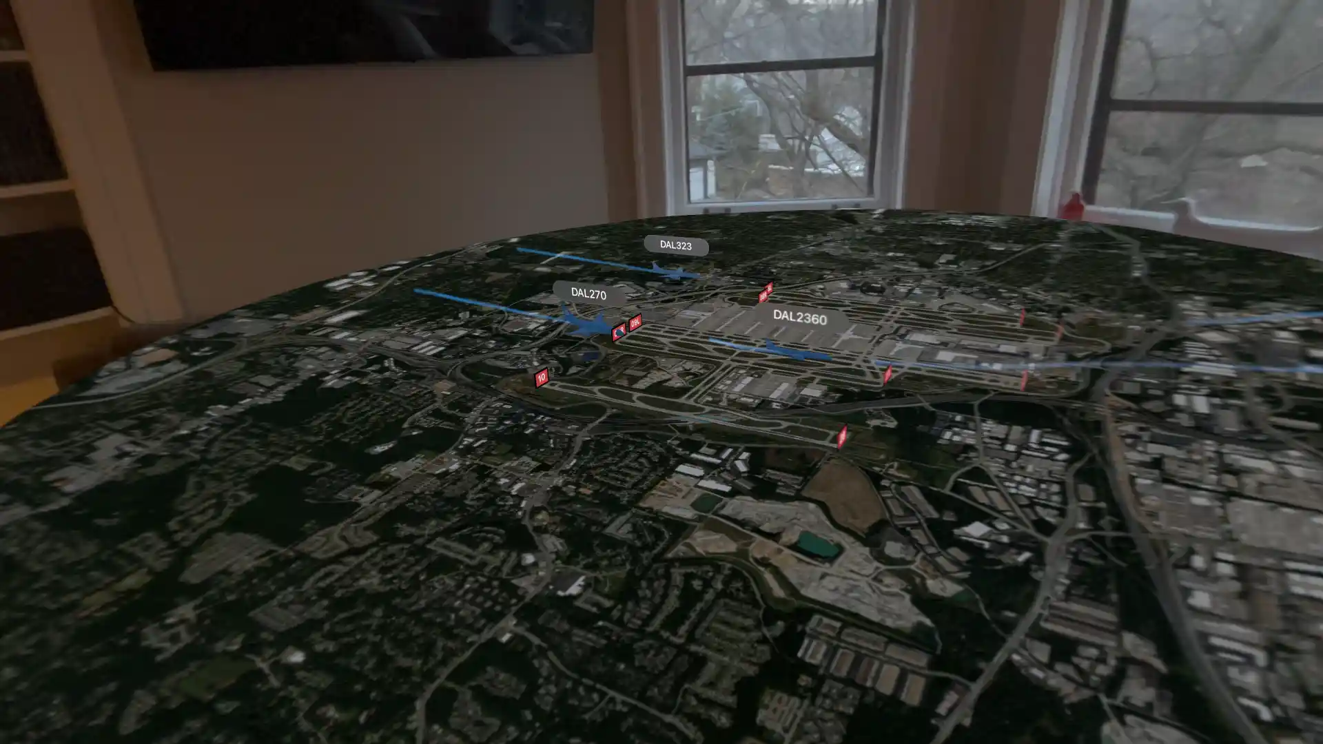
I looked at the flight details to see its speed, heading, altitude, and airplane type.
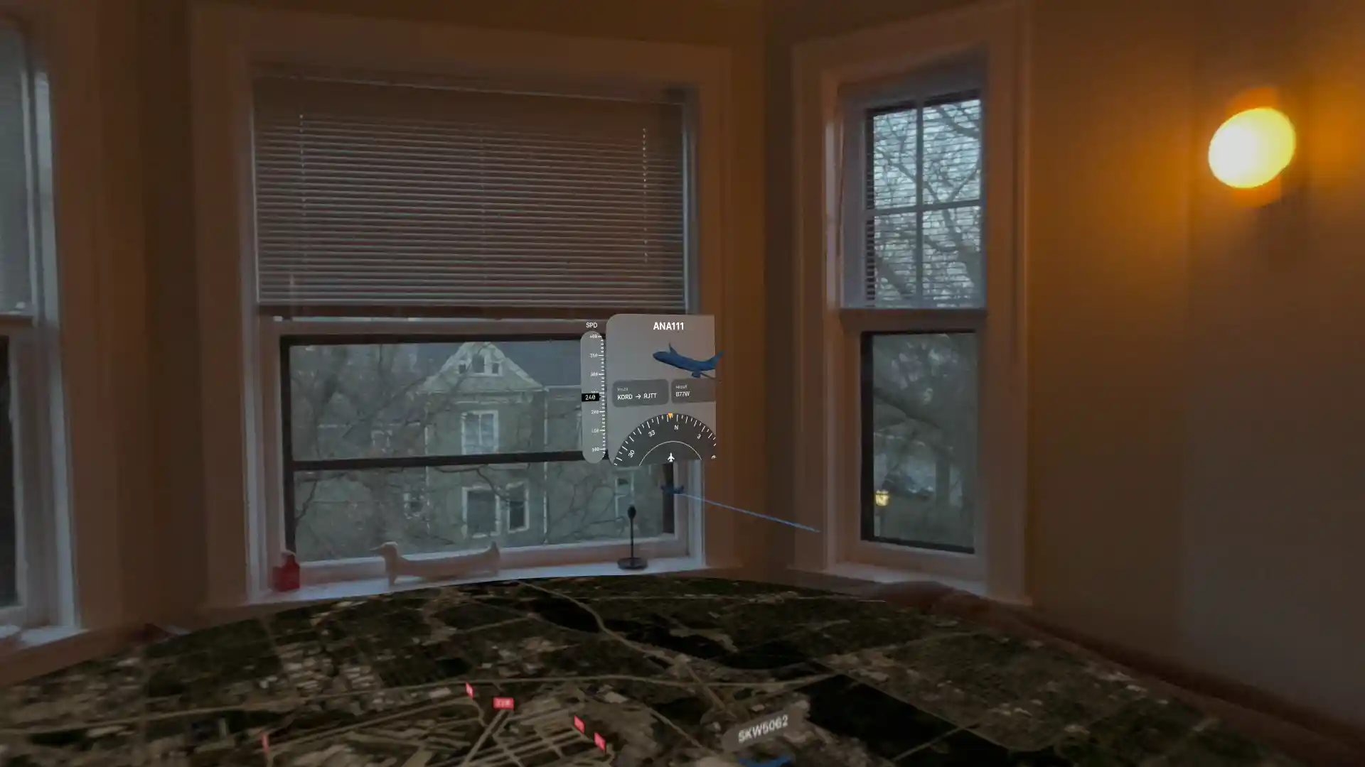
On the other side of the airport, I watched an ANA 777 dissapearing from view as it made its way towards Tokyo.
That’s all I’ve explored for now, but I have a feeling I’ll be strapping this piece of expensive machinery to my face a whole lot more thanks to ForeFlight. Admittedly, this app might not have particularly broad appeal, but, as an AvGeek, I’m smitten.

2 comments
This device is going to have a terrible effect on people’s eyes and their brain.
I definitely think there are some risks–I’m most worried about it causing people to further isolate themselves in favor of online interaction.